
Storm season in the Philippines is in full swing, and you are once more monitoring the news on TV and social media for the latest updates regarding the weather. While some areas in Metro Manila are unaffected by storms, others are truly disaster-prone.
Every year, more than a dozen locations make it to various lists put together by government agencies like the Metropolitan Manila Development Authority (MMDA) or the country’s weather bureau, PAGASA. We’ll look at a few key areas and examine why they are typhoon danger zones.
As a reference on flood and storm surge hazard levels, we used the information provided in the hazard tracking map of the Nationwide Operational Assessment of Hazards (NOAH) of the Department of Science and Technology (DOST).
Flooded Crossroads: Taft and España’s Storm Season Story
Locations: Taft Avenue and España Boulevard, City of Manila
Flood Hazard Level: Medium to High
Storm Surge Level: High (for Taft Avenue)
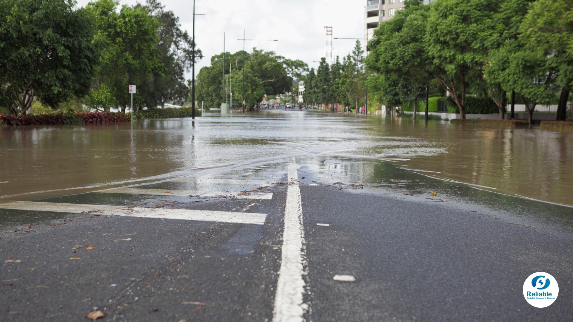
Taft Avenue runs through several cities in Metro Manila. From Pasay in the south to Caloocan in the north, and its proximity to Manila Bay makes it particularly vulnerable to flooding. Manila Bay is just a short walk west of the avenue until it crosses the Pasig River at Lawton, Manila. Some of the heaviest flooding often occurs in the stretches within the City of Manila between Quirino and UN Avenues.
For España, it’s really the area near the University of Sto. Tomas and Far Eastern University, which gets heavily flooded; there are pictures of the UST field looking like a lake after a heavy downpour, and it's marked red on the NOAH hazard map.
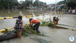
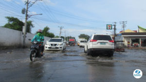
Why These Areas Are Typhoon Danger Zones: Both are major thoroughfares with constant vehicle and foot traffic flow around the clock. A trifecta of high tide, heavy rainfall, and rush hour traffic can make these two roads look more like rivers, trapping pedestrians, commuters, and vehicles in deep floodwaters.
The incidence of flood-borne diseases is also high, given that the areas surrounding these two streets are heavily commercialized, which almost always leads to badly managed garbage bins and street-level sanitation. Add to that the fact that several major hospitals, including the Philippine General Hospital, are located along these streets.
Risk Mitigation: Fortunately, Taft Avenue is also home to Line 1 of the Light Rail Transit (LRT) system. While it’s constantly crowded at the best of times during rush hours, the LRT-1 is an easy and quick way to bypass the flooding below.
Unless you need to do something somewhere along España itself, it can also be easily bypassed through Line 2 of the LRT and the roads below it. While the area also suffers from flooding, it is often rarely as bad as España, and Recto Avenue and the University Belt can easily be reached through the LRT Line 2, which connects to Line 1 at Taft.
Commuters who need to commonly pass through these areas might find tall rain boots a good investment, as they allow you to walk through the murky waters. Residents near the affected disaster zones could do with ensuring their local drainage systems are free of clogging before a major storm, and moving important equipment and appliances to the second floor, if available.
Northern Waters: CAMANAVA’s Constant Flood Fight
Location: Northwest of Metro Manila
Flood Hazard Level: High
Storm Surge Level: High
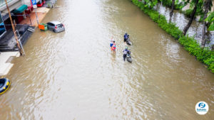
The Caloocan–Malabon–Navotas–Valenzuela (CAMANAVA) sub-region of Metro Manila holds more than just the distinction of being a region of old churches, fishing villages, and good food: it is one of the most flood-prone locations of the metropolis.
On the NOAH Hazard Map, nearly all of the cities of CAMANAVA are red in color.
Why These Areas Are Typhoon Danger Zones: Any locale right beside a large body of water is at risk of storm surge during really bad weather, and CAMANAVA is this kind of area. Of its component cities, only Valenzuela is inland enough to be relatively less at risk than its sisters.
What makes it worse for the region is the fact that large parts of it are below sea level. There are areas in Navotas and Malabon, for instance, that are like Venice most of the year, with streets resembling rivers more than roads.
Geography and topography make CAMANAVA very vulnerable to extreme weather during storm season.
Risk Mitigation: Longtime residents of the region know the best measures to take when dealing with storms and floods, so if you’re new there, it’s best to ask the locals for best practices when the weather goes bad.
If you have the budget for it, a motorized pump could help reduce flooding on your property. Because of CAMANAVA’s unique geography, the standard pail might not suffice. A motorized pump might be enough to keep up with rising waters during storms.
Check out more ideas in our article on protecting your home when you live in a high-risk area.
Marikina City: Still Vulnerable After Ondoy and Ulysses
Location: East of Metro Manila
Flood Hazard Level: High
Storm Surge Level: Little to None
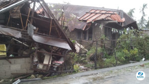
Marikina sits at the Eastern border of Metro Manila with the Province of Rizal. Known for its shoe industry, the region, especially the city, was one of the worst hit by Typhoon Ondoy in 2009. Provident Village, a subdivision in Marikina near its eponymous river, earned national infamy as one of the worst-hit neighborhoods. Marikina was again hit by a similar disaster in 2020 when Typhoon Ulysses came and made the waters of the Marikina River swell higher than Ondoy’s record.
Why Is It a Typhoon Danger Zone? Marikina City, like CAMANAVA, is a victim of geography, topography, and unchecked human development: it is a valley that acts as a catch basin for waters coming from the mountains of Rizal to the east and Quezon City to the north.
It also doesn’t help that the river the city shares a name with is right there and acts as one of the main conduits for all that water. When the Marikina River breaches 15 meters above sea level (the support struts of bridges across the river are clearly marked), people are forced to evacuate. During Ondoy, it breached 21.5 meters, a record at the time. Ulysses, more than a decade later, went up to 22 meters.
The high levels of urbanization, despite the dangers of the region, also figure into this disaster zone. The weather and the waters it brings can only go where the land leads them to. It just so happens that the catch basin for all that water now has thousands of humans living on it.
Risk Mitigation: One way to deal with flood zone issues would be to build high. But in Marikina, 2-storey houses went underwater during Ondoy and Ulysses. The increasing strength of storms often sees the Marikina River breach the 15-meter mark every wet season.
Locals know to keep a keen eye on the news during heavy rains, especially local government monitoring of the Marikina River. Sirens are used to signal when residents must evacuate and move to higher ground. In a high-risk area like Marikina City, information is key, so always keep an eye or ear on reports.
Having a bugout bag could also be crucial. Keep important documents, water, food, medicines, and possibly a power bank or two, in a bag you can easily grab when the sirens give the call to evacuate.
The Role of Insurance in Disaster Recovery
The people of Marikina knew the dangers of floods from Ondoy, but the repeat performance by Ulysses still caught them off guard. For moments like that, all you can do is leave with your loved ones as quickly as you can to safe ground.
While no material possessions are worth one’s life, insurance plans can help mitigate damage and losses from natural disasters. While the premiums might be higher given the greater risk in areas like Marikina and CAMANAVA, having coverage for your possessions and property could help ease the costs of rebuilding once the floodwaters subside.
Health plans during storm season can also be a boon, if not a lifesaver. Floods are disease factories, and the extreme weather can try the hardiest of bodies. Medical access can be hard to come by at this time, so having health insurance could at least ensure you will have access to medical care.
Reliable Insurance Brokers offers a wide range of insurance options for you, your loved ones, and your property. We have a wide variety of coverage for any budget and every need, so you and yours will get the protection you demand in these challenging times.
Contact us today to learn how we can help keep you and your loved ones safe and healthy, and your property protected, no matter how high the floodwaters rise.
Contact Information for Inquiries and Support
If you have any questions or need assistance with your insurance, feel free to reach out to us:
- Call: +63 2 8631 9285 to 86
- Mobile: +63 917 138 5120
- Email: info@reliable-insurance.ph
- Messenger: m.me/reliable.insurancebrokersph
Sources:
- Nationwide Operational Assessment of Hazards (2005), Know Your Hazards Map.
- Rappler (2024, April 24), La Niña may happen in 2024. Here are the flood-risk areas in Metro Manila.
- MoneyMax (2023, June 23), Flood-Prone Areas in the Philippines: Places to Avoid While Driving.